
CARB Planning and Capacity Building Projects
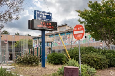
Cherokee Point Elementary School
City Heights – Building the Bus Planning Capacity
for Under-resourced Students and Seniors (C-BUSS)
Cherokee Point Elementary School in City Heights, San Diego, is leading the C-BUSS project to plan a zero-emission, battery-electric community school bus that would carry chronically absent K-5 students to and from school and transport isolated local seniors to food, healthcare, and social resources during the day. Working with CirculateSD, DelCommunity, technical consultants, transit agencies, and local government partners, the team will run a 12-month community needs assessment to understand transportation barriers in three low-income census tracts. The findings will shape a Community Bus Deployment Plan and a ready-to-submit Implementation Proposal Package that the school can use to pursue future funding. The goal is to reduce chronic absenteeism, improve senior mobility, and build the community’s own capacity to plan and win zero-emission transportation grants. The project is designed as a replicable pilot for other under-resourced schools across the district.
California Health Collaborative
Linda Clean & Safe Transportation Initiative
The California Health Collaborative is leading the Linda Clean & Safe Transportation Initiative, a community planning project to make walking, biking, and transit safer in the rural, unincorporated community of Linda in Yuba County. Building on prior Mobility Zones engagement that reached over 200 residents, the project will establish a resident-majority Community Advisory Board, conduct two phases of multilingual outreach in Spanish, Hmong, and English, and gather data on where residents feel unsafe and what changes would help. The goal is to produce documented community data summaries and a prioritized list of 1–2 community-supported transportation projects that Linda can use to compete for future planning and implementation funding. Because this is a planning grant, residents won’t see construction during the grant period, but they will gain practical safety information, stronger local leadership, and a real seat at the decision-making table. The project is designed to leave Linda better prepared to shape transportation decisions long after the grant ends.

Karuk Clean Transportation Pathways
The Karuk Department of Transportation is leading the Karuk Clean Transportation Pathways project, a community-led planning effort serving the Karuk Tribe and residents along the remote Highway 96 corridor between Orleans and Happy Camp in the mid-Klamath region. Most households here are low-income and must travel one to three hours through rugged terrain to reach medical care, affordable food, and essential services, while sparse transit and unreliable electricity leave the community feeling “left behind” in California’s clean energy transition. The project has two goals: identifying realistic pathways for low-carbon, whole-community clean transportation, and building the planning and business capacity to sustain a new transit link connecting Happy Camp and Orleans. Through community meetings and targeted focus groups with elders, youth, cultural practitioners, and first responders, the team will ground its solutions in local lived experience rather than urban models. By the project’s end, the Tribe will have an actionable investment roadmap and the staff capacity to manage a safe, affordable, and climate-aligned transportation system.
Moving Together Imperial
Comité Cívico del Valle (CCV) is leading “Moving Together Imperial,” a project to assess the feasibility of a community-centered electric vehicle rideshare and microtransit program serving Imperial County, one of California’s most environmentally and economically overburdened regions. The county’s small, far-flung communities face unreliable fixed-route transit and costly travel options, leaving low-income residents, seniors, farmworkers, and Spanish-speaking households struggling to reach work, school, medical appointments, and basic services. The project envisions an all-electric rideshare program that hires and trains residents as drivers, complementing CCV’s existing EV charging infrastructure and clean-transportation initiatives. Guided by a community advisory committee with real decision-making authority, the team will study service design, pricing, labor models, and operations to produce a grant-ready implementation roadmap. The goal is to reduce transportation inequities, expand access to essential services, and advance clean, reliable, affordable mobility in the Imperial Valley.
Association of Monterey Bay Area Governments (AMBAG)
Ride Forward Monterey
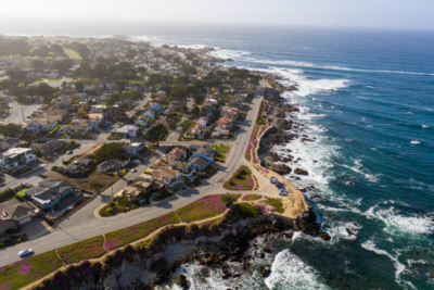
The Association of Monterey Bay Area Governments (AMBAG) is leading Ride Forward Monterey, a feasibility and planning project to design community e-bike lending libraries for transportation-burdened communities across Monterey County, including Pajaro, Castroville, and the Salinas Valley. Residents here, predominantly Latino, immigrant, and working-class families, face high transportation costs, long commutes, unsafe walking and biking conditions, and persistent first/last-mile gaps. Building on prior regional mobility and Safe Routes to School planning, the project will screen candidate sites, run multilingual resident-led engagement, and produce 2–4 implementation-ready feasibility packages along with a Hartnell College–aligned e-bike technician workforce pathway. By grant close, communities will have tested engagement models, governance frameworks, and funding roadmaps, positioning them to launch affordable, community-run e-bike libraries. The goal is to expand clean, low-cost mobility, build local workforce capacity, and strengthen long-term transportation equity.

Yurok Tribe Clean Transportation Planning Project
The Yurok Tribal Transportation Department (YTTD) is leading the Yurok Tribe Clean Transportation Planning Project, an effort to advance reliable, sustainable transit for the Yurok Reservation, a highly rural and isolated region along the Klamath River in Northern California, where average incomes are around $11,000, poverty is widespread, and many households lack personal vehicles. The project pairs clean-energy infrastructure planning with community outreach: it will plan and design a rooftop and carport solar (PV) system and EV charging infrastructure for YTTD’s Tulley Creek facility, while assessing transportation needs for preschool and school-aged children served by Yurok Head Start and the Klamath-Trinity Joint Unified School District. The work will produce two implementation-ready deliverables, a PV/EV Planning Package and an Implementation & Funding Strategy, that position the Tribe to pursue future capital funding. The goal is to strengthen transit reliability, accelerate fleet electrification, build durable renewable power in an outage-prone region, and keep resources focused within Tribal programs. It is designed to advance equitable access for transit-dependent Tribal and non-Tribal low-income families.

Southern California Tribal Chairmen’s Association (SCTCA)
Bridging the Transportation Divide for SoCal Tribes
The Southern California Tribal Chairmen’s Association (SCTCA) is leading “Bridging the Transportation Divide for SoCal Tribes,” a project that addresses mobility and access barriers constraining Tribal communities across San Diego, Riverside, San Bernardino, and Imperial Counties. Many of SCTCA’s 26 Member Tribes occupy remote lands with inadequate roads, few EV chargers, and infrastructure left vulnerable to wildfires, floods, and other hazards, the result of systemic exclusion from transportation planning for generations. The project establishes a Tribal-led framework for assessing, planning, and funding transportation solutions tailored to each Tribe’s cultural and geographic context, delivered through a Technical Assistance Team that follows the lead of Tribal governments rather than prescribing solutions. It will provide strategic planning, grant-writing support, job training, participation stipends, and a comprehensive Tribal transportation toolkit, while building the capacity of the Tribal Energy & Climate Collaborative (TECC). The goal is safer roads, reliable transit for elders, climate-resilient infrastructure, and a self-sustaining cycle of Tribal-led transportation development that strengthens sovereignty and resilience.

Promotoras for Transportation Justice
The San Francisco Study Center, together with the Center for Latino Advocacy, Resources & Organizing (CLARO), is leading Promotoras for Transportation Justice, a project to make the mobility needs of San Francisco’s Latino communities visible and to translate them into community-led transportation priorities. Latinos make up nearly 28% of SFMTA ridership, the highest of any ethnic group, yet often travel off-peak on complex, trip-chained journeys hampered by unreliable service, unsafe crossings, and safety concerns that fall hardest on women, youth, seniors, immigrants, and people with disabilities. The project adapts the proven public-health Promotora model into a Transportation Justice Promotora model, recruiting and paying trusted community members to lead bilingual outreach, survey design, and direct data collection at transit stops and pedestrian crossings. Working with SFMTA and community partners, the team will map Latino travel patterns and safety barriers, validate findings through community workshops, and produce an Outreach Plan and a Needs Assessment. The goal is to lay the foundation for a future Latino Community-Based Transportation Plan with prioritized, actionable improvements, while building a lasting workforce of community transit-justice leaders.

Connect South Merced
The City of Merced is leading Connect South Merced, a community-driven transportation safety planning project for South Merced, a historically disadvantaged community physically and economically isolated by the 1960s realignment of State Route 99. Many of its roughly 23,104 residents are low-income, non-English-speaking, and dependent on walking, biking, and transit, yet they navigate corridors that make up the city’s High Injury Network with missing sidewalks, unsafe crossings, and high vehicle speeds. Partnering with the trusted community organizations Valley Onward and Merced Lao Family, the City will establish a South Merced Collaborative Governance Structure to guide inclusive, resident-led decision-making, conduct culturally responsive “reach-in” engagement, and run workshops and design charrettes to shape safety and active transportation concepts for priority corridors. The goal is to produce community-informed corridor concepts, build lasting local planning capacity, and create a durable governance structure that positions South Merced to compete for future implementation funding. By the end of the grant, residents will hold real influence over transportation decisions that have historically been made without them.
Bombay Beach Clean Mobility & Community Action Plan
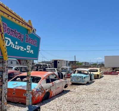
United for Justice, Inc. is leading the Bombay Beach Clean Mobility & Community Action Plan, a project to create the first comprehensive, resident-driven mobility framework for Bombay Beach, a small, rural community on the eastern shoreline of the Salton Sea. Despite being a designated SB 535 Disadvantaged Community and AB 1550 low-income community, Bombay Beach has no public transit, no transportation plan, no safe mobility routes, and has never received clean mobility investments, leaving residents to walk, bike, or rely on neighbors for every essential trip. Working with the Bombay Beach Community Services District and the Calipatria Latin American Club, and guided by a 10-member resident Community Advisory Group, the project will document mobility gaps through surveys, community meetings, and door-to-door outreach, then develop the community’s first Clean Mobility & Community Action Plan. The plan will evaluate options including walking routes, bicycle lanes, a legal golf cart route, EV chargers, and income-based EV incentive programs. The goal is to position Bombay Beach to pursue implementation funding and ensure it is no longer excluded from statewide transportation and climate investments.
Mead Valley ACCESS Plan (Advancing Clean, Connected, Equitable, Sustainable Streets)
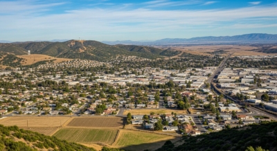
The County of Riverside is leading the Mead Valley ACCESS Plan (Advancing Clean, Connected, Equitable, Sustainable Streets), a community-based planning effort for Mead Valley, a rural, unincorporated, predominantly Hispanic community under mounting pressure from rapid warehouse and logistics industrialization. Adjacent to I-215 and bisected by Cajalco Road, the community of roughly 19,500 residents faces worsening air pollution from truck traffic, rural roads ill-suited for heavy vehicles, few sidewalks, no bicycle facilities, and truck parking spilling into residential neighborhoods. Partnering with TODEC and a network of trusted community organizations, the County will conduct an inclusive, bilingual engagement process, including workshops, design charrettes, and stakeholder meetings, to assess transportation needs and shape a long-range plan for active transportation, EV and micro-mobility infrastructure, and truck route and parking solutions. The goal is to reduce industrial impacts and reliance on cars while preserving Mead Valley’s rural identity, integrating transportation with land use, and building lasting community capacity. By the end, the community will have an equitable, zero-emission transportation plan rooted in residents’ own vision for their future.
Future Paths Grass Valley: Everyday Mobility Connecting People and Places
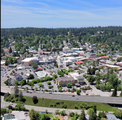
The City of Grass Valley is leading Future Paths Grass Valley: Everyday Mobility Connecting People and Places, a community-guided planning project to improve safe, affordable ways to travel without a car in this small rural Sierra Nevada foothills city of about 14,000 residents. Although neighborhoods, schools, and daily destinations are often close together, fragmented sidewalks, limited bicycle facilities, and missing connections make walking and biking difficult and often unsafe, disproportionately affecting students, families, low-income households, elders, people with disabilities, and members of the Nevada City Rancheria Nisenan. Partnering with Bear Yuba Land Trust and a broad network of community partners, the project will plan a connected network of off-street greenways and shared-use paths that link housing, schools, and destinations through open space, while piloting a school-focused bicycle education program and incorporating Indigenous knowledge into how paths are designed. Guided by two community advisory cohorts and methods like participatory mapping and walk-and-roll audits, the work will produce community-informed priority routes and implementation-ready concepts. The goal is to advance transportation equity, reduce reliance on car trips, and position the community for future funding and long-term climate benefits.
West Oakland Job Resource Center (WOJRC)
Greater Bay Communities Clean Transportation Careers Project
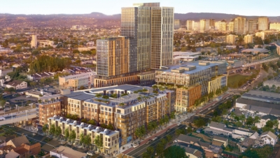
The WOJRC (West Oakland Job Resource Center) is leading the Greater Bay Communities Clean Transportation Careers Project, an effort to expand transportation equity by connecting disadvantaged Greater Bay Area communities to the jobs being created by California’s clean transportation transition. As the state moves toward zero-emission vehicles under Executive Order N-79-20, most community residents remain effectively excluded from the career pathways opening up across the Clean Transportation Ecosystem and Supply Chain, a gap deepened by employers who often don’t participate in workforce development and by training that doesn’t yet exist for emerging industries. Working with the Port of Oakland, unions, training institutions, employers, and community partners, the project will research workforce barriers, engage workers and businesses, and pilot a “career concierge” that links low- and moderate-income jobseekers, including justice-involved and housing-insecure residents, to skilled employers. The goal is to bridge environmental justice with economic justice by building a roadmap and a new workforce system that connects community members to living-wage careers in clean transportation manufacturing. By the project’s end, it aims to lay the groundwork for a regional training and job-development system responsive to community needs.

Morongo Band of Mission Indians
Tribal Clean Mobility Planning & Capacity Project
The Morongo Band of Mission Indians is leading the Tribal Clean Mobility Planning & Capacity Project, an effort to strengthen community capacity and advance equitable clean transportation planning on the Morongo Reservation, a 35,000-acre community at the foot of the San Gorgonio and San Jacinto Mountains. Bisected by the heavily trafficked I-10 freeway, the Reservation faces poor air quality, pollution exposure, and limited access to information about EVs, charging, and clean mobility options, with elders, youth, low-income households, and people with disabilities most affected. Led by the Morongo Environmental Protection Department, the project will develop educational materials for the Tribal community and Morongo School, organize and analyze transportation data, and engage Tribal staff and stakeholders to produce a Transportation Needs Assessment and a prioritized list of clean transportation projects. It will also research funding opportunities to support future implementation. The goal is to lay the foundation for clean transportation investments that reflect Tribal priorities, reduce service gaps, improve safety, and expand access to clean, reliable, affordable mobility for those most affected by these challenges.
Santa Ana Safe Mobility Ambassadors Initiative
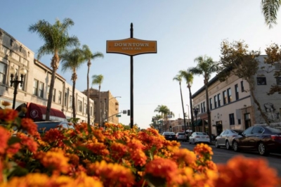
Latino Health Access (LHA) is leading the Santa Ana Safe Mobility Ambassadors Initiative, a planning and capacity-building project to improve transportation and mobility safety in Santa Ana, a dense central Orange County city where 50% of households do not own a vehicle and residents rely heavily on walking, biking, and e-bikes. Working-class, predominantly Latino neighborhoods bear a disproportionate share of traffic injuries and fatalities, and infrastructure installed with limited community engagement has widened safety gaps and even led to the criminalization of youth for e-bike and cycling behaviors in areas where municipal code changes were never communicated. Using a popular education and promotor/community health worker model, LHA and its partners will train residents and youth as Safe Mobility Ambassadors who lead grassroots education, data collection, and community dialogue. The project will also convene the City of Santa Ana and the School District to align active transportation safety efforts around community input. The goal is to build community power and cross-sector collaboration that reduces traffic violence and advances equitable transportation outcomes in Santa Ana’s most divested neighborhoods.
Community Capacity for Clean Transportation Futures
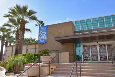
The City of Pico Rivera, with partners Day One and Public Matters, is leading a project to transform short-term, project-by-project outreach into a lasting civic learning system that prepares residents to understand, shape, and benefit from clean transportation investments. Located almost entirely within SB 535 Disadvantaged Communities, this densely populated, predominantly Hispanic city of 61,751 faces high vehicle speeds, sidewalk gaps, disconnected bike routes, and transit stops lacking shade, seating, and information, even as major regional investments like Metro light rail expansion, a new rail station, and a Bus Rapid Transit corridor approach over multi-year and multi-decade timelines. The project will strengthen and connect the City’s existing Stakeholder Advisory Group and Youth Ambassador program, use real transportation projects as hands-on learning platforms, support community-led visioning, and produce a reusable engagement “kit-of-parts.” Prioritizing households without vehicles, seniors, youth, people with disabilities, and Spanish-speaking residents, the goal is a sustained, community-driven engagement system that builds trust, advances equity, and ensures continuity across long planning timelines, while creating a replicable model for other communities facing similar change.